



Bloomington Indiana tornadoes became a major concern in 2026 after two significant tornadoes affected Monroe County within four months. On February 19, an EF2 tornado struck western Bloomington near Bloomington Monroe County Airport. Then, on June 17, an EF3 tornado crossed from Owen County into northern Monroe County, passing north of Bloomington itself.
The final ratings matter because early news reports gave lower estimates for both storms. Therefore, anyone researching Bloomington tornado history should use later National Weather Service damage surveys rather than relying only on reports published the morning after a storm.
Quick Answer: Bloomington Indiana Tornadoes
| Question | Answer |
|---|---|
| Did Bloomington, Indiana have tornadoes in 2026? | Yes. An EF2 struck western Bloomington on February 19, while an EF3 crossed northern Monroe County on June 17. |
| February 2026 rating | EF2 |
| February estimated peak wind | 120 mph |
| February path length | 3.73 miles |
| June 2026 rating | EF3 |
| June estimated peak wind | 140 mph |
| June path length | 18.49 miles |
| June maximum width | 880 yards |
| June injuries | 1 |
| June fatalities | 0 |
| Monroe County tornadoes, 1950–2025 | 22 in the current NWS historical table |
| Main safety action | Take shelter immediately when NWS issues a tornado warning for your location |
NWS data also show how unusual 2026 became across Indiana. By June 30, the agency had counted 77 tornadoes statewide, already exceeding the previous annual record in the record that begins in 1950. June alone produced 58 tornadoes, the highest monthly total in the state record. NWS notes that June figures remain subject to final Storm Data review.
Key Facts About the 2026 Bloomington-Area Tornadoes
| Feature | February 19 tornado | June 17 tornado |
|---|---|---|
| Area | Western Bloomington/airport | Owen and northern Monroe counties |
| Final rating | EF2 | EF3 |
| Estimated peak wind | 120 mph | 140 mph |
| Maximum width | 440 yards | 880 yards |
| Path length | 3.73 miles | 18.49 miles |
| Main Bloomington relationship | Directly affected western Bloomington | Passed north of central Bloomington |
| Final-rating issue | Early coverage reported EF1 | Early coverage reported EF2 |
| NWS later assessment | EF2 | Upgraded to EF3 |
What Happened With Bloomington Indiana Tornadoes in 2026?
Two confirmed tornado tracks made 2026 especially notable for Monroe County. However, they did not follow the same path or affect the city in the same way.
The February storm directly crossed western Bloomington. Meanwhile, the June tornado developed farther west and tracked through northern Monroe County.

February 19, 2026: EF2 Tornado Hits Western Bloomington
Thunderstorms developed near a warm front across central Indiana on February 19. The system produced tornadoes, damaging winds, and large hail, including hail reports around Bloomington.
NWS now lists the Bloomington-area tornado as EF2, with estimated peak winds of 120 mph. Its track measured 3.73 miles, while its maximum width reached 440 yards. The official statewide list identifies it with Monroe County and BMG Airport.
NWS storm reports also recorded a 70 mph gust at Bloomington Monroe County Airport and damage at the Monroe County Humane Association. In addition, hail reports around Bloomington reached 1.5 inches.
Why Some Sources Still Say EF1
Early reporting created an understandable discrepancy.
On February 20, Weather.com said officials had given the tornado an EF1 rating while survey teams continued examining the damage. The article itself described the story as developing.
Later NWS records list EF2, not EF1. Therefore, articles published immediately after the event can now contain an outdated intensity rating even when their initial reporting was accurate at publication time.
June 17, 2026: EF3 Crosses Owen and Monroe Counties
The June tornado became the stronger of the two 2026 Bloomington-area events. NWS ultimately rated the Owen-Monroe County tornado EF3 and estimated peak winds at 140 mph.
The tornado started about two miles north-northeast of Spencer at 9:44 p.m. EDT. It continued east for 18.49 miles and ended six miles south-southeast of Martinsville at 10:07 p.m.
The tornado reached a maximum width of 880 yards, or roughly half a mile. NWS recorded one injury and no deaths.
Why Early Reports Called It EF2
The initial June 18 survey estimated EF2 intensity, 130 mph peak winds, and a path of at least 15.35 miles. Local reporting consequently used EF2 when covering the storm the next day.
However, investigators continued surveying the track.
On June 26, NWS upgraded the tornado to EF3, raised the peak wind estimate to 140 mph, and extended the track to 18.49 miles. Therefore, the EF3 rating represents the later official assessment.
Did the June Tornado Hit Bloomington City?
The June 17 EF3 affected Monroe County, but its main tornado track stayed north of central Bloomington.
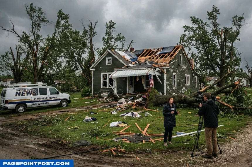
Local officials reported damage in rural areas outside Stinesville, near Gosport and the southern Morgan County border. Reports included downed trees and power lines, affected structures, and one injured person.
The distinction matters for the keyword Bloomington Indiana tornadoes. News headlines often use Bloomington because it is the best-known city in Monroe County, even when a tornado travels through rural communities several miles from downtown.
What Happened Near I-69?
The June storm crossed the northern part of the county and affected travel.
Indiana Daily Student reported that officials temporarily closed lanes of Interstate 69 because trees and power lines had fallen near the storm track. Later, crews reopened the highway.
Therefore, the tornado had a significant Bloomington-area impact even though it did not carve a path through downtown Bloomington.
How Many Tornadoes Have Hit Monroe County?
The current NWS historical page lists 22 Monroe County tornadoes from 1950 through the end of 2025. That list includes events in Bloomington, Ellettsville, Stinesville, Stanford, Elwren, and other parts of the county.
However, that table stops before 2026.
Adding the February EF2 and June EF3 from separate NWS 2026 records gives 24 Monroe County tornado events from 1950 through June 2026. This figure represents a straightforward combination of the existing 1950–2025 county table and the two documented 2026 events rather than an updated NCEI county total.
Researchers can search official historical storm records through NOAA’s Storm Events Database.
Notable Bloomington and Monroe County Tornadoes
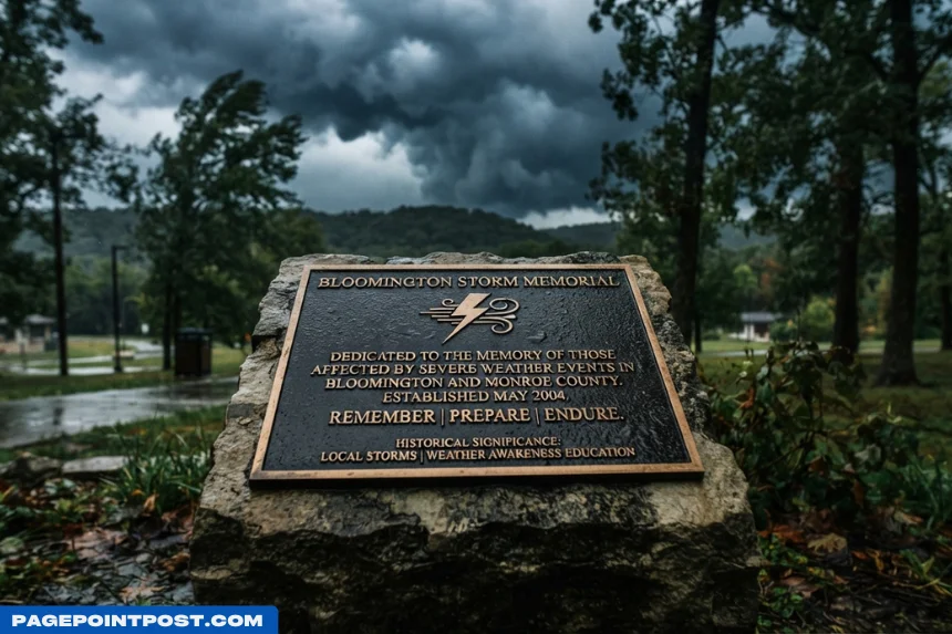
Tornado activity around Bloomington did not begin in 2026. In fact, the county record contains several F2, F3, EF2, and EF3 events.
1992: F3 in Monroe County
On November 22, 1992, an F3 tornado affected Monroe County. The NWS historical table records three injuries from that event.
That storm also shows why Bloomington residents cannot treat tornadoes as exclusively spring or early-summer hazards.
2002: F3 Begins at Ellettsville
On September 20, 2002, a major tornado began in Ellettsville and continued northeast across Indiana.
NWS says the long-track tornado traveled 112 miles and reached F3 intensity at Ellettsville, Martinsville, and Greenwood. Across its full path, officials recorded 130 injuries but no deaths.
2019: EF2 Near Ellettsville
On June 15, 2019, an EF2 tornado hit near Ellettsville.
NWS estimated 130 mph peak winds, a 3.7-mile track, and a maximum width of 400 yards. The tornado shredded trees in places and damaged barns and outbuildings.
2023: EF3 Near McCormick’s Creek and Stinesville
The March 31, 2023, outbreak produced an EF3 that crossed Owen County into northwestern Monroe County.
NWS estimated 153 mph peak winds and a four-mile path. Two people died and two suffered injuries; importantly, NWS reported the fatalities at McCormick’s Creek State Park in Owen County before the tornado crossed into Monroe County.
2025: EF2 at Elwren
The NWS Monroe County list records an EF2 at Elwren on May 16, 2025. Therefore, Monroe County experienced another significant tornado less than a year before the February 2026 event.
Bloomington Indiana Tornadoes Timeline
| Year | Bloomington/Monroe County event |
|---|---|
| 1958 | First tornadoes in the current NWS county table |
| 1992 | F3 Monroe County tornado |
| 2002 | F3 begins at Ellettsville |
| 2004 | Two F0 tornadoes listed specifically at Bloomington during May and August |
| 2011 | EF1 at Kirby |
| 2019 | EF2 near Ellettsville |
| 2023 | EF3 crosses from McCormick’s Creek area toward Stinesville |
| 2025 | EF0 at Diamond and EF2 at Elwren |
| Feb. 19, 2026 | EF2 crosses western Bloomington/airport area |
| June 17, 2026 | EF3 crosses Owen County into northern Monroe County |
The historical record confirms that tornado risk does not stop at the Bloomington city limits. Moreover, rural northern and western Monroe County communities have experienced several of the area’s strongest tornadoes.
Was 2026 an Unusual Tornado Year in Indiana?
Yes. By June 30, 2026 had already set Indiana’s tornado-year record in the NWS dataset that begins in 1950.
NWS counted 77 tornadoes statewide through June. The previous listed record was 72 in all of 2011.
June contributed heavily to that total.
June 2026 Set a Monthly Record
NWS counted 58 Indiana tornadoes in June 2026, compared with the previous June record of 44 in 1990.
Furthermore, the June 17–18 episode produced eight tornadoes statewide, including the EF3 Owen-Monroe tornado.
However, NWS labels the June data preliminary until final review and publication in Storm Data. Therefore, publishers should attach the June 30 cutoff rather than describing 77 as a final full-year total.
What Does an EF2 or EF3 Rating Mean?
The Enhanced Fujita Scale estimates tornado intensity from documented damage; it does not usually represent a direct wind measurement inside the tornado.
The scale runs from EF0 through EF5. An EF2 corresponds to estimated three-second gusts of 111–135 mph, while EF3 covers 136–165 mph.
The February Bloomington tornado’s 120 mph estimate fits EF2. Meanwhile, the June Owen-Monroe tornado’s 140 mph estimate falls within EF3.
For a detailed explanation, see NOAA’s Enhanced Fujita Scale.

Why Can a Tornado Rating Change?
Survey teams inspect damaged homes, buildings, trees, utility structures, and other indicators.
Later surveys can uncover stronger damage or extend a previously known path. Consequently, NWS may revise an initial rating, as it did with the June 17 tornado.
That process explains why fast news coverage and finalized NWS records sometimes disagree without either source necessarily having made an error at the time.
What Should Bloomington Residents Do During a Tornado Warning?
When a tornado warning includes your location, move to shelter immediately. Do not wait to see the tornado because rain, darkness, trees, and terrain may hide it.
NWS recommends a basement when one is available. Otherwise, use a small interior room on the lowest floor, stay away from windows, and protect yourself from flying debris.
Read the official NWS tornado safety guidance before severe weather threatens.
What Should Indiana University Students Do?
Indiana University gives similar instructions for students, employees, and visitors.
A tornado watch means tornadoes and severe thunderstorms are possible, so people should monitor conditions. A tornado warning means radar or spotters have identified a tornado threat in the area, and people in the warning zone should take shelter immediately.
The university recommends basements, lower-floor interior hallways, or small interior rooms away from windows and exterior doors.
IU students can review Protect IU tornado guidance before the next severe-weather day.
Do Tornado Sirens Mean a Tornado Hit Bloomington?
No. A siren or warning indicates a threat that requires action; it does not prove that a tornado crossed your exact address.
Radar can detect strong rotation before a tornado reaches the ground. In addition, warning polygons often cover several communities along the storm’s projected path.
Therefore, residents should respond to the warning first and determine the exact tornado track later.
FAQs About Bloomington Indiana Tornadoes
1. Did a tornado hit Bloomington, Indiana in 2026?
Yes. NWS lists an EF2 tornado in Monroe County near Bloomington Monroe County Airport on February 19, 2026. Moreover, an EF3 crossed northern Monroe County on June 17.
2. How strong was the February 2026 Bloomington tornado?
NWS ultimately rated it EF2 with estimated peak winds of 120 mph. The tornado traveled 3.73 miles and reached a maximum width of 440 yards.
3. Was the February Bloomington tornado EF1 or EF2?
The final NWS listing says EF2. Early February 20 reporting called it EF1 while the damage assessment remained underway, which explains the conflicting information online.
4. How strong was the June 17, 2026 Monroe County tornado?
NWS upgraded the Owen-Monroe tornado to EF3 with estimated peak winds of 140 mph. In addition, the final survey listed an 18.49-mile track and an 880-yard maximum width.
5. Did the June 2026 tornado hit downtown Bloomington?
The documented EF3 track ran through northern Monroe County rather than downtown Bloomington. However, the storm affected the broader Bloomington area, including roads and rural communities near Stinesville and the Morgan County line.
6. Was anyone injured in the June Bloomington-area tornado?
Yes. NWS recorded one injury and no fatalities along the June 17 Owen-Monroe track. Therefore, later survey information provides a clearer answer than the earliest storm reports.
7. How many tornadoes has Monroe County had?
The current NWS county history lists 22 from 1950 through 2025. Adding the February and June 2026 events produces 24 through June 2026, although the historical county page itself has not yet incorporated those two events.
8. What was the strongest tornado near Bloomington?
The historical county record includes several F3 or EF3 tornadoes, including events in 1992, 2002, 2023, and 2026. However, comparing older F-scale ratings directly with modern EF-scale surveys requires care because the United States changed rating systems in 2007.
9. Does Indiana University have tornado safety guidance?
Yes. Protect IU tells people in a warning area to move away from windows and exterior doors and use basements or lower-floor interior spaces. Moreover, students should identify their nearest shelter before severe weather develops.
10. What is the safest place during a tornado in Bloomington?
A basement or designated storm shelter provides the best option in a sturdy building. Otherwise, NWS recommends a small interior room on the lowest floor, away from windows, while you protect your head and body from debris.
Conclusion
The history of Bloomington Indiana tornadoes became especially significant in 2026. NWS ultimately rated the February 19 western Bloomington tornado EF2 with 120 mph estimated peak winds, while the June 17 Owen-Monroe tornado reached EF3 with 140 mph estimated winds.
Those final assessments also correct two common online discrepancies. Early coverage called the February storm EF1, while early June reports labeled the later tornado EF2. Continued surveys raised the official ratings to EF2 and EF3 respectively.
However, 2026 is only part of the area’s tornado history. Monroe County’s NWS table already contained 22 tornadoes from 1950 through 2025, including several strong events around Bloomington, Ellettsville, Stinesville, and Elwren.
Ultimately, Bloomington residents should treat tornado warnings seriously regardless of whether a storm eventually crosses downtown. Knowing your shelter location, monitoring official alerts, and acting immediately during a warning provide far more protection than waiting to see a funnel.